
GPS Chartplotters
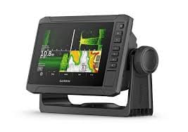
A GPS chartplotter is a marine navigation device that integrates GPS data with electronic navigational charts (ENCs), displaying the vessel’s position, heading, and speed on a digital map. This integration enhances navigational accuracy and safety by providing real-time information and situational awareness. Modern chartplotters offer advanced features such as fish finding, radar integration, and Automatic Identification System (AIS) capabilities, allowing mariners to customize their navigation experience based on specific needs.